For the first time, Google Maps has a public transport update accessible to anyone in England.
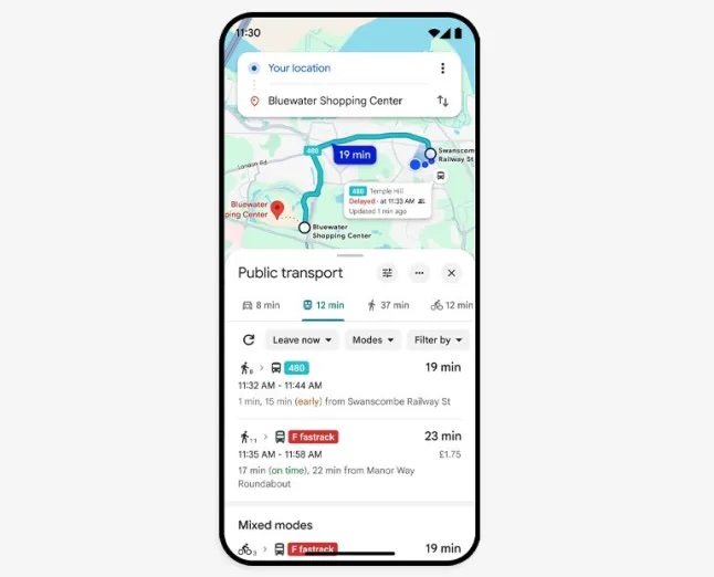
To save all of us from the dreaded frustrations of waiting around. Aimlessly hoping for our transport to arrive, Google Maps has launched a brand new update. A new tracking feature, which allows people to keep an eye on the status of their bus and whether it’s actually due to arrive.
This update is an absolute game-changer. Allowing people to not only plan their travel more efficiently, but also provide any evidence to pesky managers who might find their work lateness an excuse for laziness.
What does the update mean?
The upgrade allows travellers to live track vehicles everywhere within England. Allowing people from major and busy cities like Manchester, Birmingham and London (which all heavily rely on public transport), to stay up-to-date with accurate transport resources.
If you ask any Londoner, they will tell you that Transport for London (TFL) is more unreliable than it likes to take credit for. It’s hard to predict whether your bus or train is coming, even with the updates literally on the screen.
- Dr Linda Lee: From Engineer to Harvard Surgeon — Lessons in Innovation, Authenticity and the Future of Medical Aesthetics
- The Easiest Way to Learn Crypto Without Investing Your Own Money
- Opportunities Board UK: Explore Jobs, Internships & Grants
- The Skills Employers Are Actually Paying For Right Now
- How to Secure Funding for Your Business as a Young Founder
